Public transport planning and permit management system
Client
State Transport Authority, OdishaServices
Transformed public transport with geospatial technology, developing web-based permit management system, route optimization, transparency, efficiency, and citizen empowerment.Mobility & Public Transport
Provisioning of an efficient Transport System is the key to economic development. In the heart of the rural landscape lies an opportunity to transform lives through an efficient and inclusive public transport system. With the background of expertise in geospatial technologies, SPARC has been entrusted with development of the Public Transport permit management system for all the intra-state and inter-state bus counting to about 10,000 in numbers. Our partnership with the Odisha State Transport Authority marked the beginning of a transformative journey aimed at bringing efficiency, reliability and transparency to the existing public transport system through state-wide implementation of a Web GIS based Stage Carriage Permit Management System.
Development of Transport Network Geodatabase
The first step in our endeavor was to establish a robust foundation. The initial steps involved development of a comprehensive geo-database to include all Stage Carriage permits, mapping of bus stops and timings. This provided a structured Geodatabase framework to build upon the permit management information system.
Preparation of District-Wise Transport Master plans
District-wise transport master plans were prepared showing the entire road network for the districts, bus atoms, important junctions on a base map which were submitted to the respective district transport authorities for verification and approval. Identification of the route with low population density, low demand and high population density with high demands vs the existing bus permits were represented on the map to enable the district authorities in appropriate decision making for identification and planning for the routes and public transport needs. The unique challenges posed by the distribution of habitations over vast areas, low population density, and fluctuating demand patterns. Geospatial processings were carried out for identification of connected and unconnected habitations, demand locations such as educational and healthcare centers, markets, and tourist hotspots, the decision makers were assisted with necessary inputs for decision making in terms of route augmentation, permit enhancements, cancellation of routes etc. This exercise was carried out at all regional Transport Authorities in all districts. The input collected from the decision authorities were summarized to form the final transport network.
From Data to Action: Web-Enabled Permit Management System
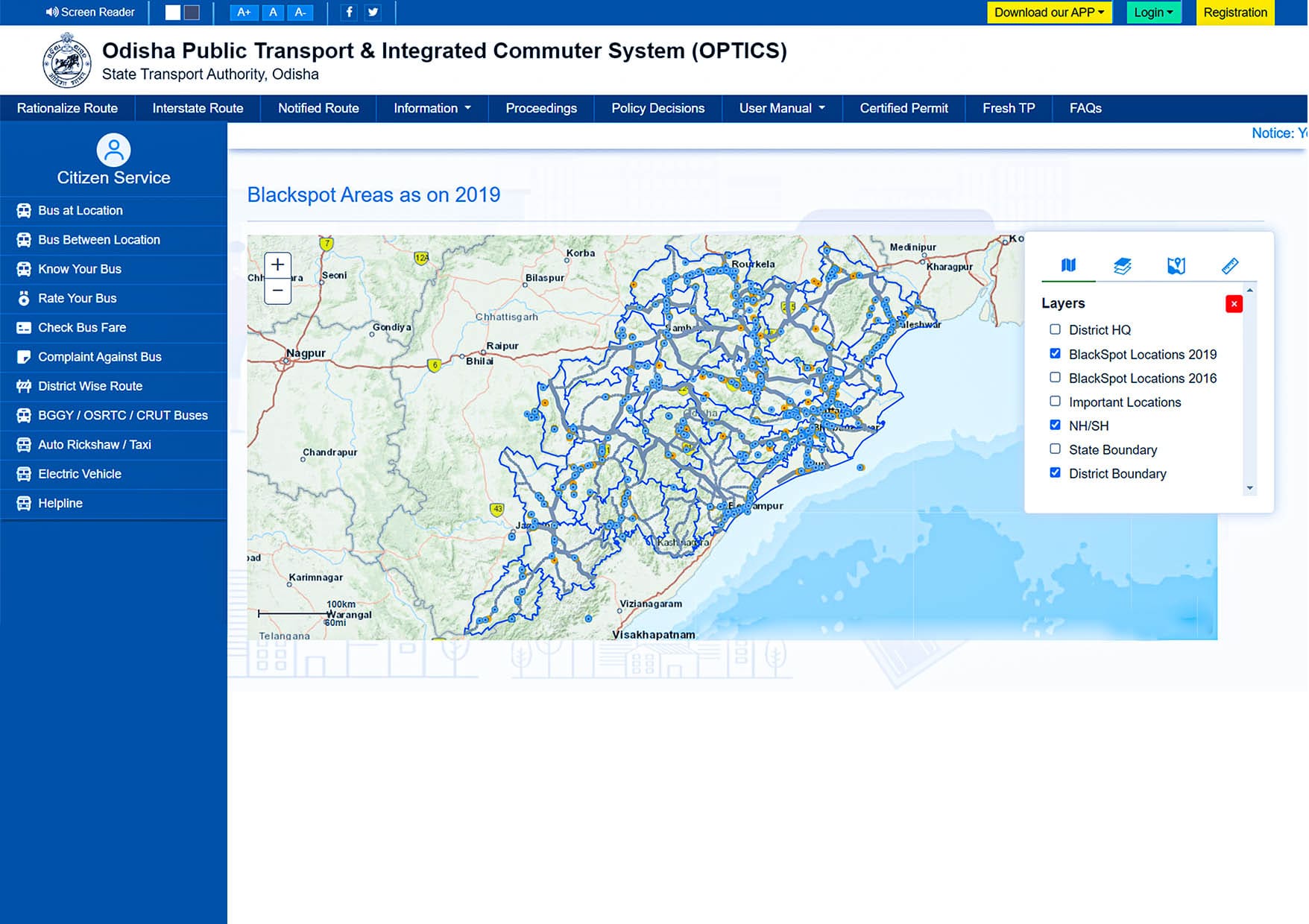
Translating data into action is where our innovation truly shines. The geo-database incorporating the decisions was seamlessly web-enabled to develop and implement the Stage Carriage Permit Management System that leverages the underlying geodatabase features and attribute information efficiently to serve the public transport information to the system users with increased efficiency and transparency. The system facilitates online facilities for Permit Application, Verification, Online Payment of Fees through integration of Payment Gateway apart from the Mapview, Bus Scheduling. The System also provides a number of service modules which are coherently integrated with the core modules to provide seamless transport services across the state. Besides, there are mobile baked application to provide transport service information on Mobile devices. The system is being proactively used by the State Transport Authority, All Regional Transport Authorities across the state, Bus owners and the general public to access relevant public transport information and services.
Key features
Online Map Interface for permit applications and validations: Bringing-in convenience, transparency and operational efficiency to the bus owners as well as the STA & RTA officials.
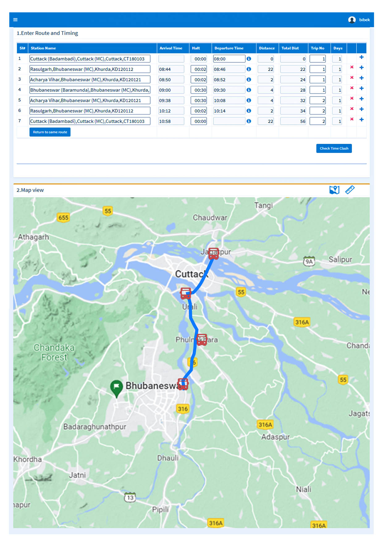
Route Rationalization & Time Clash management: Optimisation of route coverage and preventing conflicts and streamlining operations through meticulous time management.
Dashboards for Insight: Providing bus owners and officials with comprehensive summarized and statistical information on the public transport scenario and operational status.
Transparent Workflow: Implementing a permit management workflow that prioritizes transparency and fairness.
Verification of Compliance: Ensuring compliance by verifying tax, insurance, fitness, and enforcement statuses.
Holistic Services: Offering a range of services including permit issuance, conversion, renewal, route alterations, and many more.
Empowering Citizens: A web/mobile application that empowers citizens to access bus timings and plan their journeys seamlessly.
Driving Social Equality Through Objective Planning
The Odisha Permit Management System has brought in paradigm shift in the Permit Management and rendering related services transferring the traditional sluggish and subjective approach to the online and system based objective approach presenting transparency, accountability and fairness in the overall process reducing the footfall at the transport offices while increasing the throughput of services in many fold leading to the increased public satisfaction and reduction of cost at the personal and govt. operations.

