GIS based mapping & gap analysis for locating childcare facility (anganwadi centres) in the state of Odisha
Client
Women & Child Development Department, OdishaServices
Spatial mapping, gap analysis, decision support system, data visualizationChildcare services are the first layer of social equity in rural India. Anganwadi Centres (AWCs) play a critical role in providing nutrition, preschool education, and basic healthcare at the village level. Yet, in Odisha, many villages continued to remain outside the coverage of these centres, creating invisible gaps in access. For policymakers, the real challenge was knowing where exactly these gaps existed and how to prioritize new centres without overextending limited resources.
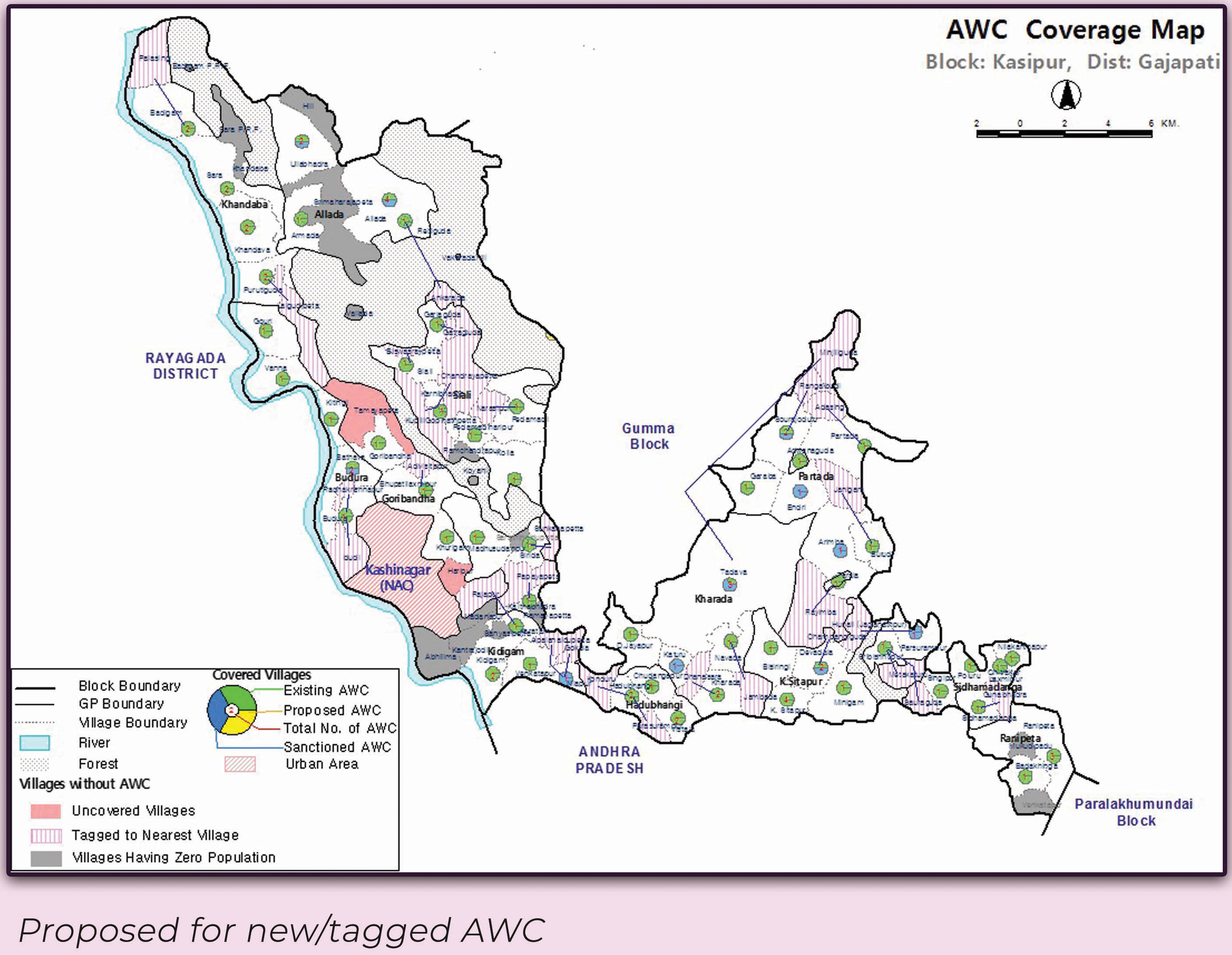
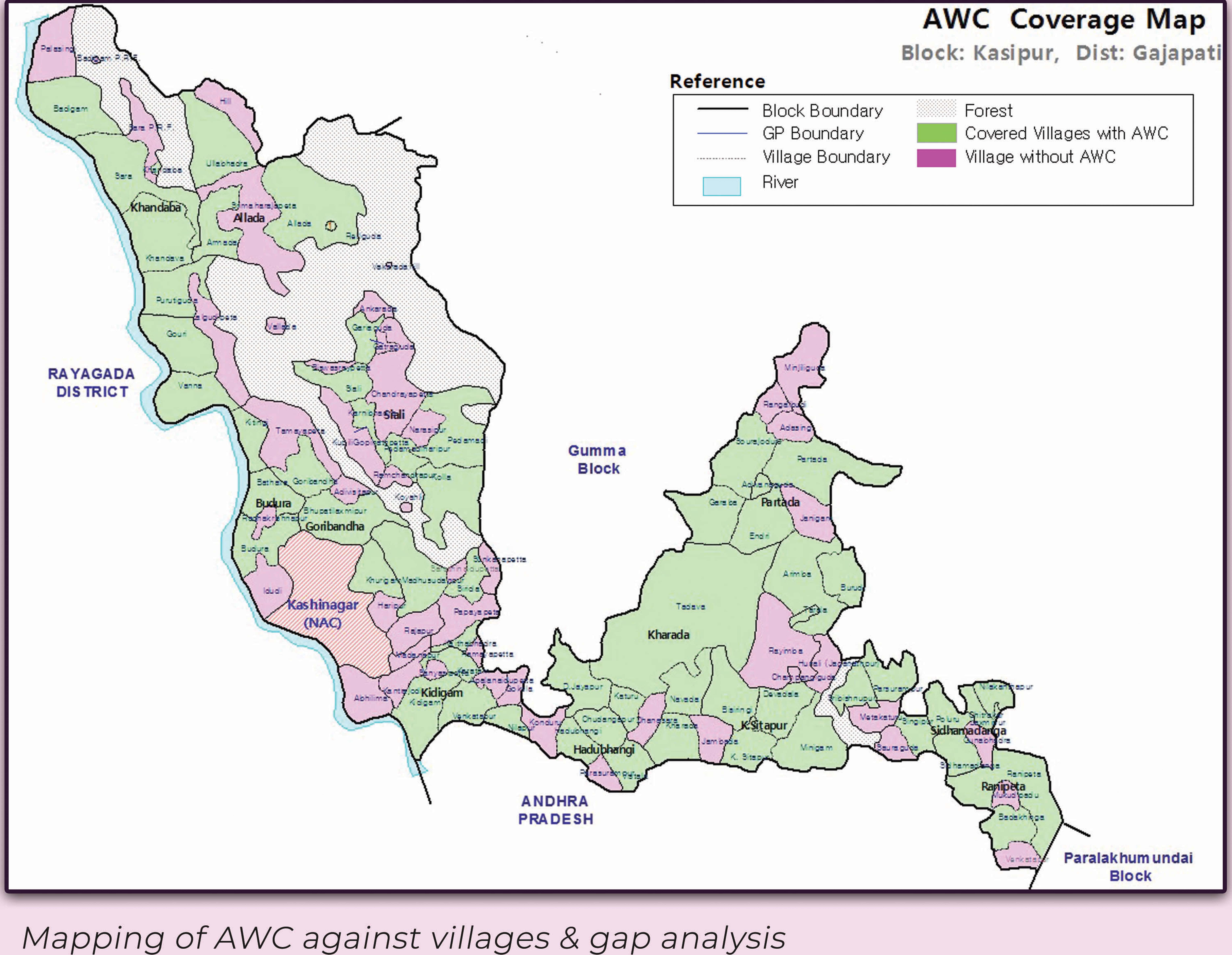
SPARC worked with the Women & Child Development Department of Odisha to address this through a GIS-enabled approach. Existing and approved Anganwadi Centres were digitized, mapped, and spatially linked to villages. This allowed planners to see, at a glance, which villages were served, which were unserved, and which could be efficiently tagged with nearby centres. Using thematic analysis and population-based requirement models at the Gram Panchayat level, SPARC delivered a powerful decision-support framework that identified shortfalls and projected future needs.
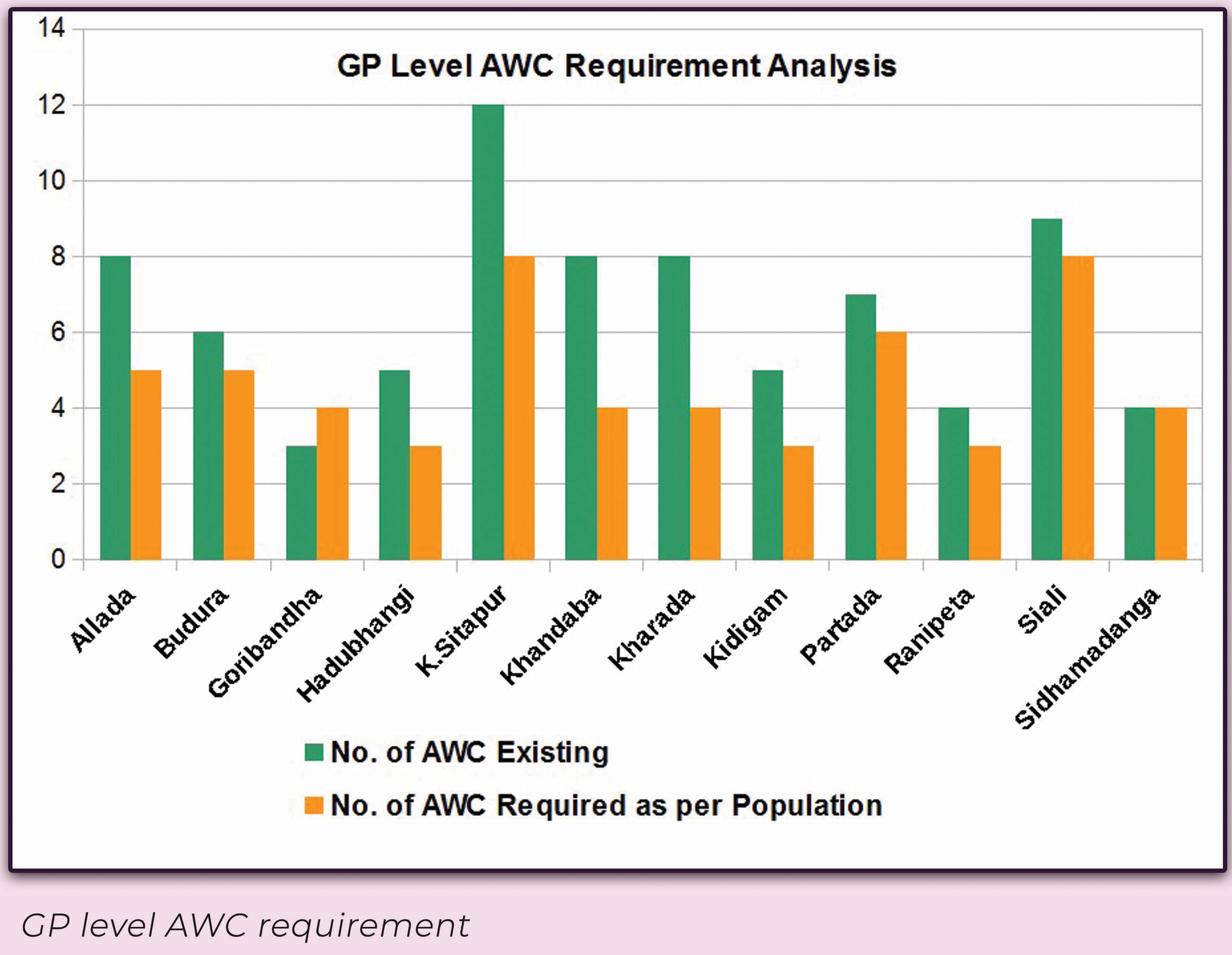
The results transformed decision-making. Instead of relying on fragmented records, the department could now visualize childcare coverage across the district in real time. Villages without AWCs were flagged, new centres were proposed, and smaller habitations were tagged to existing ones, ensuring no child or mother was left out. Resource allocation became smarter, duplication was avoided, and the delivery of social welfare services became more transparent and equitable.
The solution also set the stage for scalable innovation. With integration of real-time monitoring, mobile-based field validation, and AI-driven forecasts, such a framework can evolve into a state-wide social infrastructure dashboard, unifying health, education, and nutrition planning. By converting complex childcare delivery challenges into spatial intelligence, SPARC demonstrated how modern GIS can power inclusive governance and enable authorities to build stronger, data-driven strategies for community well-being.